AbandonedNYC
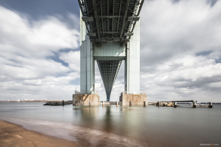
Verrazano Bridge
Approaching the “Forgotten Borough”
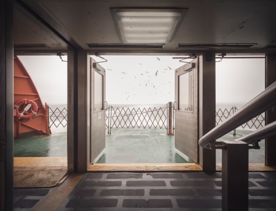
Seagulls follow in the wake of the Staten Island Ferry.
Hello friends, its been a while. I’ve been on a bit of a hiatus from poking around abandoned buildings, but I’m back now with something a little different. This is the first installment of a series on Staten Island—an area of the city that tends to go unnoticed, but is very much worth exploring.
For the unfamiliar, Staten Island stands with Manhattan, Brooklyn, the Bronx, and Queens as one of the five boroughs that make up the city of New York. It is the third largest and least populated of the five. Its identity has always been somewhat distinct from the city at large, due in part to its geographical isolation. Prior to the construction of the Verrazano Bridge in 1964, no crossing existed between Staten Island and any other borough. It remains something of an outlier today, with a suburban nature and right-leaning political tilt. A record of neglect from city government has earned it the oft-repeated title “the forgotten borough,” and the name has stuck.
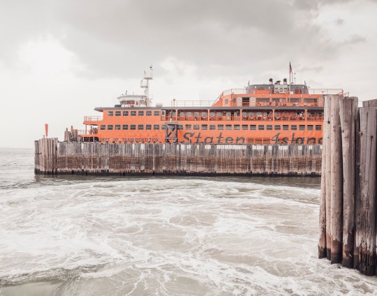
The Staten Island Ferry departs from Lower Manhattan.
From a Manhattan-centric point of view, a trip to Staten Island begins with a ride on the Staten Island Ferry. Over 21 million passengers embark on the 25-minute journey from Lower Manhattan to St. George each year. With dramatic views of the Statue of Liberty and the surrounding harbor, it’s a well-known attraction for New York City tourists. The ride is offered free of charge by the city’s Department of Transportation, but that hasn’t always been the case.

An engraving of the 1871 “Westfield” disaster.
Back in the 18th century, sailboats manned by private individuals competed for fares between Manhattan and Staten Island. In 1817, the first mechanically powered ferry service went into operation, under the direction of Captain John de Forest of the Richmond Turnpike Company. His brother-in-law Cornelius Vanderbilt took over in 1838. Existing ferry service proved inadequate as Staten Island developed, and accidents were common.
In 1871, a boiler explosion on one of the ferries claimed the lives of more than 85 passengers. Jacob Vanderbilt, the president of the Staten Island Railway at the time, was charged with murder, but never convicted. In 1901, a ferry operated by the Staten Island Rapid Transit Company collided with a Jersey Central ferry and sank into the harbor soon after departing the port at Whitehall. Though the disaster was far less deadly than the 1871 episode, city authorities used it as justification to seize control of the service by 1905.
The iconic orange color of the ferries was adopted in 1926, to increase their visibility in heavy fog and snow.
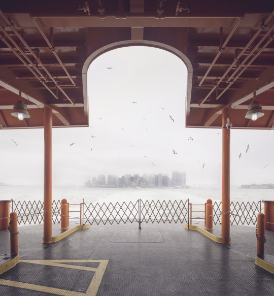
Leaving Manhattan.
A nickel fare was the rule through most of the 20th century, but was increased in 1975 to a quarter, and in 1990 to 50 cents, causing an uproar among borough residents. Coupled with mounting grievances over the Fresh Kills Landfill on the island’s west shore, the fare hike gave rise to a secession movement, which culminated in the passage of a non-binding referendum to make Staten Island an independent city in 1993.
Efforts to secede were subdued by the election of Mayor Rudy Guiliani, who rode to power due in part to overwhelming support from Staten Island voters, many of whom had been won over by his promises to close the landfill and do away with the fare. He followed through on both, abolishing the fare in 1997 and closing the landfill in 2001.
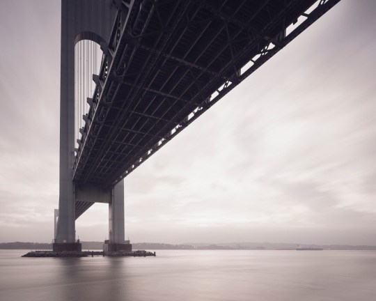
The Verrazano Bridge was the longest suspension bridge in the world at the time it was built.
While the ferry has played a significant role in the history of Staten Island, the construction of the Verrazano-Narrows Bridge has arguably had the greatest impact on its development. The story of Staten Island can generally be understood in terms of two epochs—before and after November 21, 1964, the day the bridge first opened to traffic.
Long-time residents speak longingly of Staten Island before the bridge—when country roads meandered through sweeping forests, quiet beach communities, and open expanses of farmland crawling with nanny goats. In the 19th century, full-time islanders lived side by side with some of the city’s wealthiest residents. As the industrialized city minted new millionaires, many of them looked to the rolling green hills of Staten Island as a scenic escape.
The nature of the borough was permanently altered as the Verrazano-Narrows Bridge prompted a mass migration of newcomers from overpopulated Brooklyn. The influx covered farms and forests with mile upon mile of tract housing, plaguing the island with traffic problems that persist to this day.
The official name of the Verrazano-Narrows Bridge includes a misspelling of its namesake, Florentine explorer Giovanni da Verrazzano.
As much as the borough has transformed over the years, it has retained its essential otherness. Crossing the harbor by ferry or bridge signals a psychological detachment from the urban environment of New York as we know it. In the hum of traffic, or the roar of surf, the city melts away and you enter a new frontier. Beyond and in-between the strip malls and cookie-cutter houses, scattered remnants of an older, more pastoral Staten Island await. There, Times Square feels a million miles away.
Over a series of upcoming posts, I’ll be examining the many artifacts and oddities that litter the far-flung edges of the borough, and sharing the history behind them. In the meantime, you can visit my website to see more photos from the project, “Arthur Kill Road.”
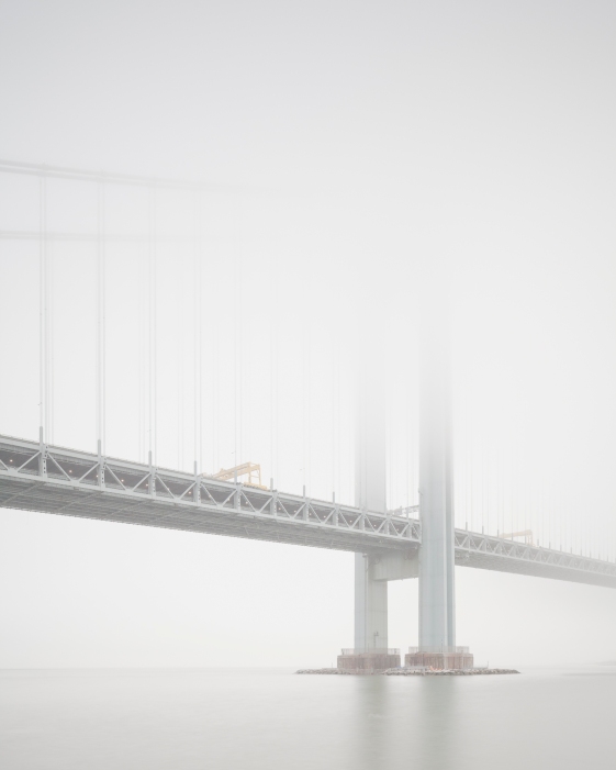
View of Staten Island obscured by fog, from Bay Ridge, Brooklyn.
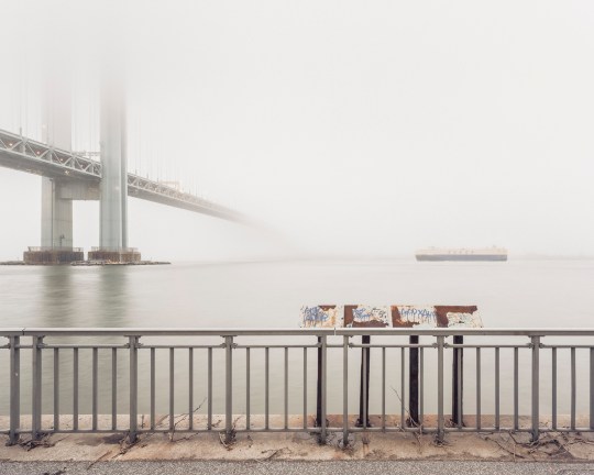
An early morning at Fort Wadsworth, on the opposite side of the span.
Wandering Fort Wadsworth

Battery Weed looms over a desolate shoreline in Fort Wadsworth, Staten Island.
At the easternmost tip of Staten Island, a natural promontory thrusts over the seething Narrows of the New York Harbor, formed by glaciers thousands of years ago. The site’s geography most recently made it a prime location for the Verrazano Bridge, but its history as a popular scenic overlook and strategic defense post dates back to the birth of the nation. The British had occupied the area during the Revolutionary War, and its first permanent structures were built by the state of New York in the early 1800s. These fortifications safeguarded the New York Harbor during the War of 1812, but were abandoned shortly thereafter. So began the familiar cycle of ruin and rebirth that characterizes the history of Fort Wadsworth.
By the mid-19th century, these early structures had fallen into an attractive state of decay. In a time when all of Staten Island held a romantic appeal as an escape from the burgeoning industrialism of New York City, Fort Wadsworth in particular was known for its dramatic terrain, sweeping views of the harbor, and evocative old buildings. Herman Melville described the scene in 1839:
“…on the right hand side of the Narrows as you go out, the land is quite high; and on top of a fine cliff is a great castle or fort, all in ruins, and with trees growing round it… It was a beautiful place, as I remembered it, and very wonderful and romantic, too…On the side away from the water was a green grove of trees, very thick and shady and through this grove, in a sort of twilight you came to an arch in the wall of the fort…and all at once you came out into an open space in the middle of the castle. And there you would see cows grazing…and sheep clambering among the mossy ruins…Yes, the fort was a beautiful, quiet, and charming spot. I should like to build a little cottage in the middle of it, and live there all my life.”
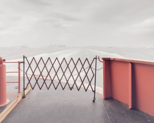
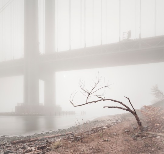
Under the Verazzano Bridge.
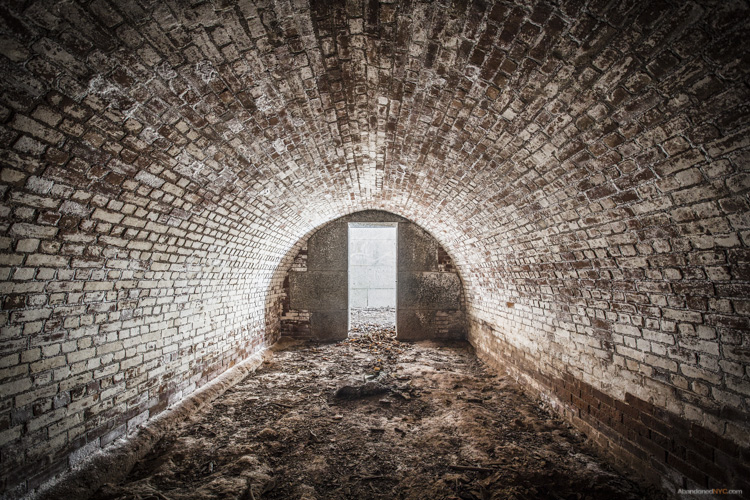
The “castle” was demolished to make way for new fortifications constructed as part of the Third System of American coastal defense, known as Battery Weed and Fort Thompkins today. The batteries remain the fort’s most impressive and unifying structures, but they too were deemed obsolete as early as the 1870s due to advances in weaponry, and were used for little more than storage by the 1890s. At the turn of the 20th century, Fort Wadsworth entered yet another phase of military construction under the Endicott Board, when the United States made a nationwide effort to rethink and rebuild its antiquated coastal defenses. Like its predecessors, the Endicott batteries never saw combat, and were essentially abandoned after World War I.
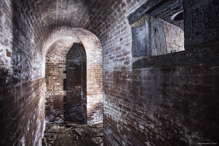
Inside a powder room of Battery Catlin.
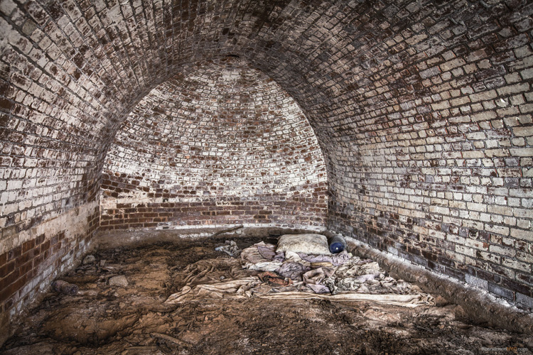
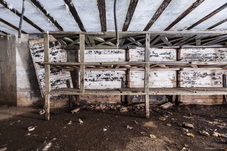
A squatter’s unmade bed in the back of the structure.
Though Fort Wadsworth was occupied by the military in various capacities until 1995, its defense structures went unused for most of the 20th century. By the 1980s, woods and invasive vines had covered areas that were once open fields, and Battery Weed was living up to its name, overtaken by mature trees and overgrowth. Since Fort Wadsworth was incorporated into the Gateway National Recreation Area in 1995, its major Third System forts (Battery Weed and Fort Thompkins) have been well maintained and properly secured, and upland housing and support buildings have been occupied by the Coast Guard, Army Reserve, and Park Police. But the headlands still retain an air of abandonment, due in large part to the condition of the Endicott Batteries, which remain off-limits to the public.
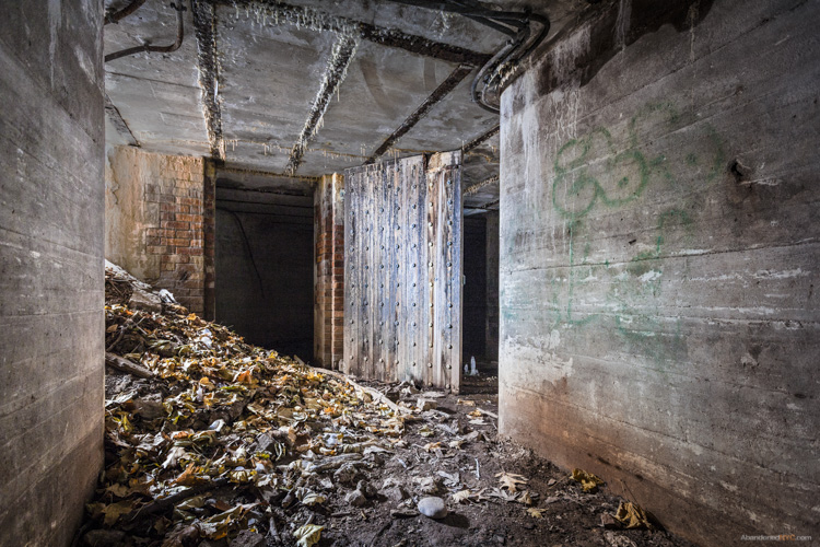
Over five of these batteries are scattered across the grounds, all in various states of disrepair.
The Endicott Batteries are filled with narrow, windowless rooms, tomblike hollows, and underground shafts.
Their military blandness stands out in contrast to the grace and grandeur of the fort’s earlier structures deemed worthy of preservation.
Layers of history peel back like an onion at Fort Wadsworth, as evidenced by a new discovery just unearthed by Hurricane Sandy. The storm caused a section of a cliff to collapse, downing several large trees and exposing the entrance to a previously unknown battery. Its vaulted granite construction places it firmly in the Third System, which means it was built around the time of the Civil War. Very little is known about the structure, except that it’s the only one of its kind at Fort Wadsworth. My best guess traces its partial construction to the 1870s, when Congress left many casemated fortifications unfinished by refusing to grant additional funding.
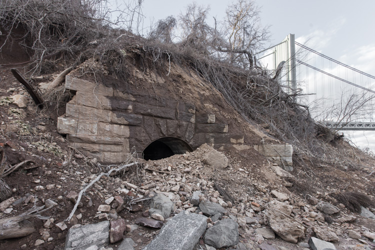
A previously unknown granite battery, possibly dating back to the Civil War, was unearthed by Hurricane Sandy.
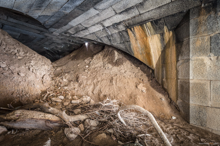
Large mounds of soil block the interior of the battery from view.
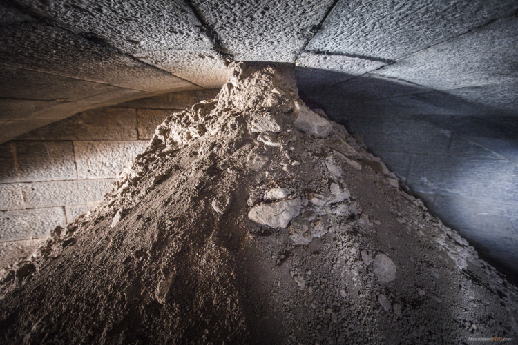
They’d been sifted through ventilation shafts in the ceiling over decades of burial.

Over the mound, the vaulted structure leads deeper into the ground.
To my disappointment, the next room came to a dead end, and to my horror, it was crawling with hundreds of cave crickets. These blind half spider/half cricket monstrosities pass their time in the darkest, dampest, most inhospitable environments, and are known for devouring their own legs when they’re hungry. They give perspective to the level of isolation of this chamber, which likely stood underground for over a century.
What other mysteries still lie buried in the lunging cliffs of Fort Wadsworth, or the depths of this forgotten battery? The dirt may well conceal deeper rooms and darker discoveries…
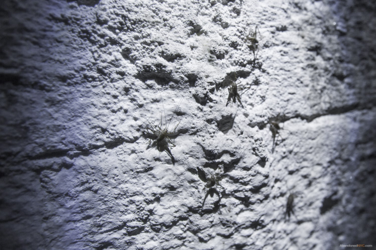
Cave crickets in the deepest room of the forgotten battery.
Special thanks to Johnnie for the tip! Get in touch if you know of a historic, abandoned, or mysterious location in the five boroughs that’s worth exploring.

Brooklyn Wild: Gravesend’s Accidental Park

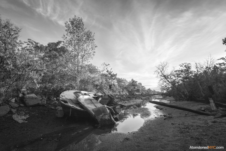
An abandoned boat wades in a narrow cove between Calvert Vaux Park and the vacant lot.
It seems like every square inch of New York City has been categorized, labeled, and filled beyond capacity. But if you know where to look on the fringes of the city, you can still find places without names.
On the waterfront of Gravesend, Brooklyn, such a place still stands. It’s an all but untraveled wedge of vacant land, nestled between aging marinas and the northern border of Calvert Vaux Park on Bay 44th St. It’s a place I can only call “the secret park,” but there’s no mention of it on the department’s website. In its place, the all-knowing Google maps shows only a dull gray transected by the mysterious Westshore Avenue, though no such road exists.

A praying mantis seeks refuge in the tall grasses of the secret park.
The small peninsula was born out of the construction of the Verrazano Bridge in the 1960s when excavated material from the project was deposited on the shore of Gravesend Bay. Most of the new land was incorporated into the existing Drier-Offerman Park, but for some reason, this small finger of land was left out of the plan. Through the 1970s, it served as an illegal junkyard, but by 1982, developers came forward with a plan to construct a seaside residential development at the site. Apparently, the project never came to fruition. The city of New York suggests environmental remediation as a condition for future development.
Concrete construction debris can be found throughout the lot.
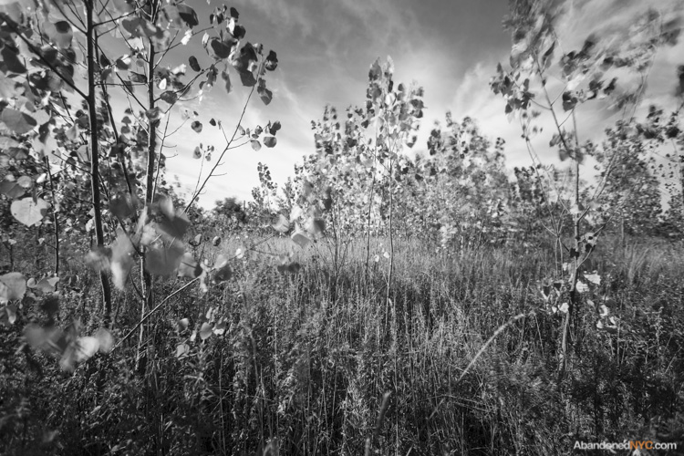
The peninsula has few trees aside from these saplings.
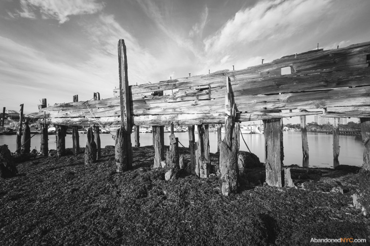
The ruins of an old marina rot on the northern edge of the property.
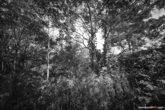
Lush foliage thrives in a wooded section behind the baseball fields of Calvert Vaux Park.
On the north shore of the peninsula, decaying pilings show the outline of a former pier and odd construction debris lie scattered throughout the landscape. A family of squatters lives comfortably out of industrial containers near the lot’s entrance, where a handful of abandoned watercraft comes to the surface at low tide. Beer cans and fire pits point to recent nights of youthful revelry, but by daytime, fishermen flock to this desolate place to cast their lines into the muddy gray waters of Gravesend Bay. At the shoreline, a few minutes of rock flipping will fetch you dozens of small green crabs. On a recent visit, I was amazed to meet two hunter/gatherers harvesting these fruits of the sea by the bucket, though I wasn’t tempted to try one.
I’d wager that it won’t be long before the development potential of the site is realized, but for the time being, the unkempt wilds of the secret park offer a rustic alternative to the paved walkways and manicured lawns of our city parks. If you’re ever looking to live off the land in New York City, you’d be hard-pressed to find a more suitable spot to pitch a tent.
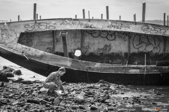
A local man goes crab hunting.
The sun sets on a creek at the north side of Gravesend’s secret park.
Top Posts & Pages

